
Christchurch to Arthur's Pass motorhome drive guide
1 days · Christchurch → Arthurs Pass
- short-trip
- south-island
- one-way
- starts-christchurch
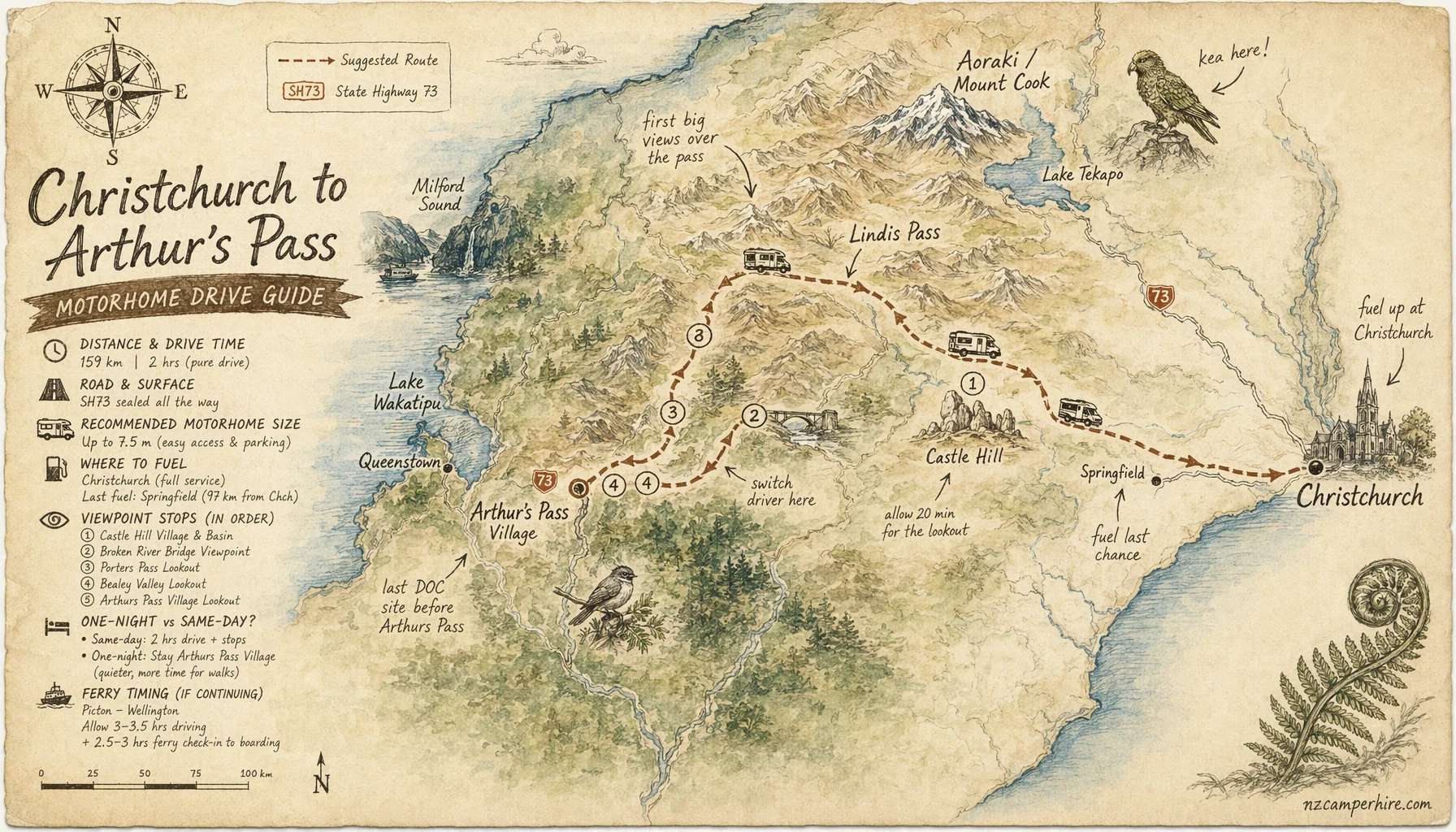
Christchurch to Arthur's Pass is the classic short alpine run out of Canterbury. It is about 150 km on SH73, usually 2 hours 15 minutes of pure driving, or 3.5 to 4 hours with Castle Hill, Cave Stream and a proper coffee stop.
This leg often sits inside a South Island in 10 days or South Island in 14 days plan, especially if you are heading on to the West Coast. March is the easiest month for settled weather, but winter needs more care because SH73 crosses high country and snow can close the road.
Get the printable drive note with the three stops timed out, or reply with your dates if you'd like a planner to fit this leg into the wider week.
The drive at a glance: distance, time, fuel
Take SH73 west from Christchurch through Yaldhurst, Darfield, Springfield, Porters Pass, Castle Hill and Arthur's Pass National Park. The road is sealed all the way. It is not a gravel shortcut. The driving changes from flat Canterbury Plains to open tussock country, then into steeper alpine bends near the national park.
- Distance: about 150 km from central Christchurch to Arthur's Pass village.
- Pure driving time: 2 hours 10 to 2 hours 25 in a motorhome.
- Realistic time with stops: 3.5 to 4 hours.
- Main road: SH73 west.
- High points: Porters Pass is 939 m. Arthur's Pass is 920 m if you continue just west of the village toward Otira.
Fuel before you climb. There are Z Energy and Caltex options around Christchurch, then BP Darfield is a sensible top-up on the way out. Do not count on fuel at Arthur's Pass village. If you are continuing west, plan your next proper fuel at Greymouth or Hokitika on the West Coast.
Three stops worth making, in order
1. Springfield. This is your last easy flat-land pause before the pass country. Use it for toilets, food and a driver reset. The road starts to feel more serious after here.
2. Kura Tawhiti / Castle Hill Conservation Area. Allow 45 to 75 minutes. The limestone boulders sit just off SH73, with marked parking and walking tracks. Large motorhomes can use the main car park, but go slowly because it gets busy in summer.
3. Cave Stream Scenic Reserve or Waimakariri viewpoints. Cave Stream is a short stop for the landscape unless you are properly equipped for the cave route. For a lower-effort stop, use the Waimakariri River viewpoints before Arthur's Pass village. Once in the village, the Devil's Punchbowl Walking Track is worth 1 to 1.5 hours if the weather is clear.
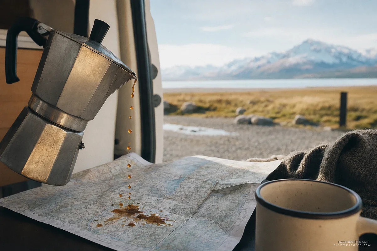
The slow part of this route is the part you'll remember. Build in at least one short evening where the kettle is the only sound — no driving, no plan, just the awning open and the day unwinding.
The two recommended pace options
Same-day to Arthur's Pass: easy in fine weather if you leave Christchurch by late morning. A 2-berth or 4-berth feels most relaxed on this road. A 6-berth is legal and common, but slower on Porters Pass and less pleasant in crosswinds.
Overnight in the national park: better if this is your first day driving on the left in NZ, or if you want a proper walk. Klondyke Corner DOC Campsite is near Arthur's Pass village and suits self-contained vehicles. Avalanche Creek Shelter Campsite is more central but small. Read the First time driving a motorhome guide before making this your first afternoon after a long-haul flight.
When not to do this drive in one day
Do not treat this as a simple 150 km city transfer in winter. From June to September, SH73 can see snow, ice, grit and chain requirements around Porters Pass and Arthur's Pass. Waka Kotahi road crews may close sections after heavy snow or high wind. If the sign says chains required and you do not have them, you wait.
Avoid leaving Christchurch late on a winter afternoon. Darkness, unfamiliar left-side driving and alpine bends are a poor mix. If you have just come down from Picton after the Cook Strait ferry, remember the Interislander or Bluebridge crossing is about 3 hours 20 minutes, closer to 3.5 hours with loading. Picton to Arthur's Pass on the same day is too much after a ferry delay.
SH73 west, 2-hr alpine drive, Castle Hill stop.
What to do once you get to Arthur's Pass
Arthur's Pass village is small. That is part of the appeal. Use it for the visitor centre, weather checks, short walks and a quiet night before dropping to the West Coast. The road west over the Otira Viaduct is steeper and more exposed than the Christchurch side, so do not rush into it if rain, fog or snow is building.
This leg pairs naturally with the West Coast region page, then Greymouth to Franz Josef if you are continuing south. If your plan later swings inland, compare it with the Christchurch to Queenstown drive guide so you understand the SH73 versus Lake Tekapo choice.
Related reading
 REGION
 Queenstown
Southern Lakes depot. Closest pickup for Milford Sound, Wanaka, Glenorchy, and the Southern Scenic Route.
See the region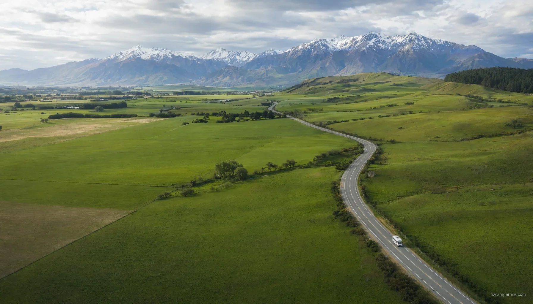 WHEN TO GO
 Best time of year for a NZ campervan trip
Month-by-month — weather, demand, school holidays, peak ferry windows.
Read the timing notes PRACTICAL GUIDE
 Cook Strait ferry with a campervan
Interislander vs Bluebridge, booking tips, what to expect, height/length limits.
Read the guideChristchurch to Arthur's Pass — motorhome drive guide FAQ
Can a 6-berth motorhome do Christchurch to Arthur's Pass?
Should we overnight at Arthur's Pass or push through to the West Coast?
Is fuel cheaper in Christchurch or Darfield?
Have a planner check this route for your dates
Send us a quick outline — dates, party size, must-sees. We come back with a vehicle recommendation and a paced route.